Statewide delivery of 3D roadway design models for construction (on beyond)
IHEEP 2024
Last updated: 2024-09-18
Why deliver 3D models for construction?
- Construction layout/measurement is accomplished through data. This is includes elevation data.
- Industry has been asking for this data in WI for many years
What changed from what we used to do?
- Used to be published documents (PDFs) submitted in a package through a web interface to an FTP server with email notification
- Added published data files (XML, DWG)
What did we need to change to make this happen?
- Publish data deliverable standards
- Change workflows/tools/data structure around new deliverables
- Publishing data and documents based on that data is different than publishing documents
- You do different things to create different deliverables
- You can create sheet views (documents) of a model (data), but you can't view a model from sheets
- Build the model first > create all the sheets you need from it > update the model > sheets update with it
- Train people on everything above
What hasn't changed from what we used to do?
- Still doing all the sheets that we used to. Data deliverables have been in addition. Why?
- We wanted to tackle the tasks of getting the design community capable of consistent 3D design data at the same level of document creation
- There are LOTS of users and processes other than construction that use the plan documents
- reviews/real estate/utilities/local officials/public - basically everyone outside design/construction
- Data deliverables are at PS&E. Not part of review process yet
- Data files are not contractual
What has worked/not worked?
- Designers are submitting data files
- Pretty good quality. Some busts in feature lines, mostly around poor corridor building
- Training a design community is a constant process, 3D deliverables are now a part
What needs to still change from current practices?
- Review of data deliverable in design process
-
Expansion of use of 3D design
Or more generally, how do you get non-tech staff using a file that doesn't end in pdf?
- General visualization (models, replace sheets and roll plots)
- Design review (measure, mark up, design checks)
Current design review
Process
- Bluebeam cloud sessions
- Region staff perform vast amount of 30/60/90 type of review (Central Office staff do a very small amount at submittal)
Features
- Asynchronous, multi-user commenting
- Markups list (with sort, filter, import, export, and multiple summary formats)
- You cannot markup data files in a bluebeam session
Autodesk options for 3D data
| Option | Description | License | File format | 3D nav | Markup |
|---|---|---|---|---|---|
| AutoCAD Civil 3D | Local, full function DWG edit/markup | AEC Coll/individual | DWG | yes | old school, Traces w/cloud |
| DWG TrueView | Local DWG software, view/print only | Free | DWG | yes | no |
| ADSK Design Review | Local review software with markup functionality | AEC Coll/individual | DWFx (published, ADSK pdf) | yes | shapes, text box, highlight, callout, stamp, cloud, cloud+ |
| InfraWorks | Local 3D surface/nav/drivethrough software | AEC Coll/individual | IWM | yes, 3D required | no |
| Autodesk Construction Cloud/Viewer | Basic web interface to models. Can publish to open webpage | Docs or higher cloud lic | DWG | yes | Issues, Markup, Only in web |
| AutoCAD on the web https://web.autocad.com | Light, ever-expanding ACAD tools in browser | Docs or higher cloud lic | DWG | yes | old school, Traces |
Recommended path forward
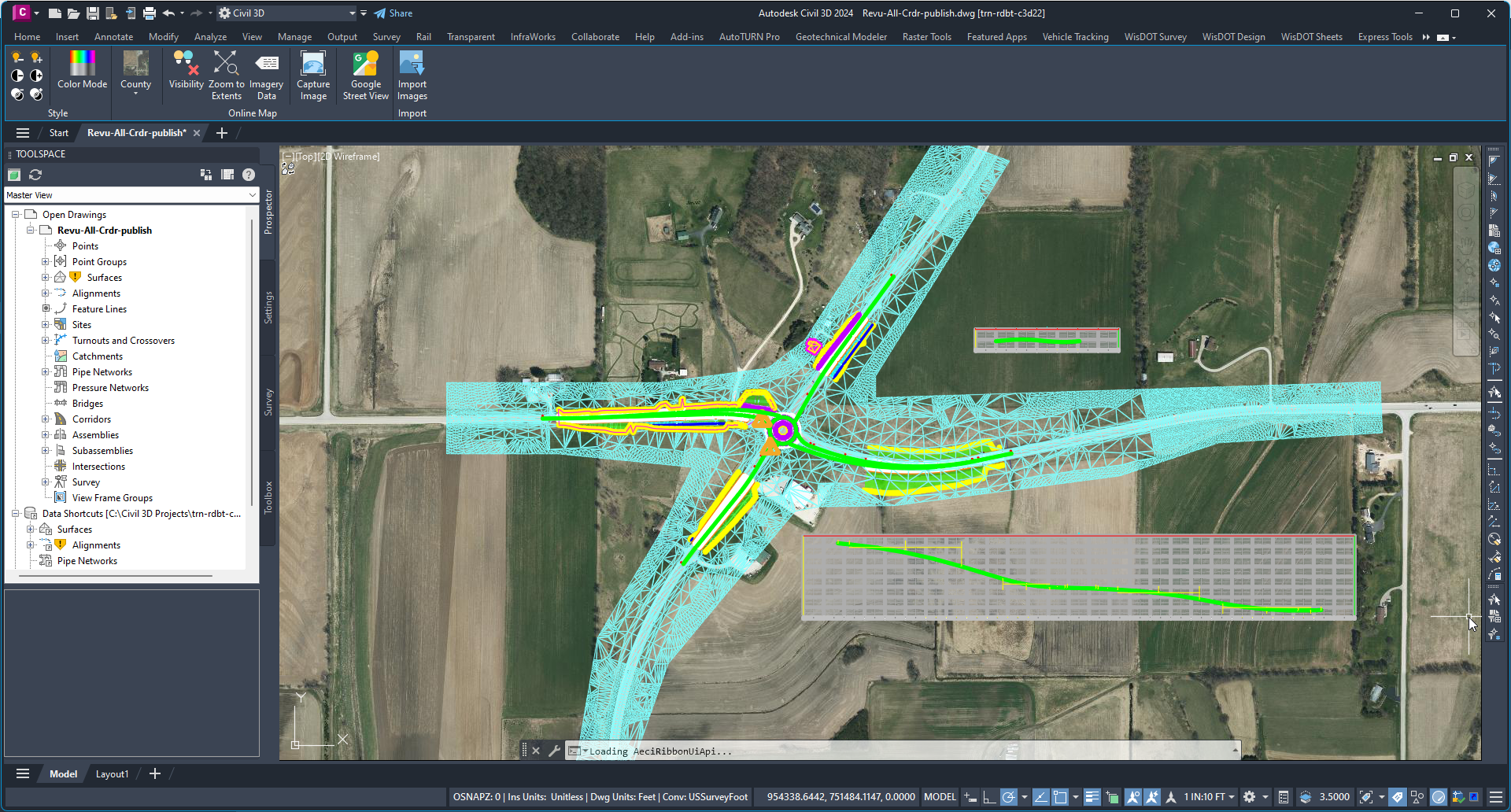
Standardized, single file view of design model
- Review file set up for non-technical staff responsible for model review (plan/profile, cross-sections, construction detail w/elevations)
- Live connection to design files (minimize update effort)
- DREF all design objects that participate in ultimate design surfaces (corridors, gradings, feature lines)
- Increase lineweight of design feature lines to enhance visibility
- Display corridors with link-based rendering
- Also DREF
- Stationed alignments and profiles
- Existing surface
- XREF
- Pavt (2D version of proposed work features)
- Topo
- Utilities (vastly underground)
- Create view bookmarks to assist in nav
- Clean up existing surface (so it doesn't cover up proposed work in cut/ditch)
- Promote Exist surface
- Create Top surfaces in design corridor footprints
- WisDOT Design tab > Design panel > Corridor - Create Corridor Surfaces (wi.gov)
- WisDOT Design tab > Design panel > Corridor - Shrink Wrap Corridor Surface (wi.gov)
- Surface tab > Surface Tools panel > Extract from Surface (border)
- Modify tab > Create Design panel pulldown > Create 2D from 3D polylines
- Add Hide boundary with non-destructive breaklines
Options at time of publish (review/display)
- Copy review file to -publish version
- Manage tab > Data Shortcuts panel > Promote All Data References
- XREFBIND all Xrefs
- Save DWG
Model review
-
Synchronous
- Sit down with Civil 3D user and navigate the file
- Asynchronous
- Publish a 3D DWFx with commandline 3DDWF (exist surface will not plot, but corridors and feature lines will)
- Publish DWG to Autodesk Viewer
Public display
Civil 3D
- Rename Top surfaces to Drop-(corridor name)-Top
- Add an edit with Surface contextual tab > Modify panel > Edit Surface dropdown > Raise/Lower Surface
- Enter an appropriate negative number to get below ditches and cuts
-
Paste the Drop surfaces into the promoted Exist surface. This will drop the surface out of the corridor footprints and leave the corridors visible
InfraWorks
- Grab lidar surface and aerial imagery data
- Build an InfraWorks model with it
- Manage tab > Content panel > Data Sources > Add Autodesk Civil 3D DWG
- Select the Drop surfaces to add
- Configure Type = Terrain
- Manage tab > Display panel > Surface Layers
- Set the Drop surfaces to Visible and set them above main terrain surface
- Manage tab > Content panel > Data Sources > Add AutoCAD DWG (3D Objects)
- GeoLocation > Coordinate System = County Coordinates
- Type = City Furniture
-
This will bring all 3D objects in as they appear at save