Export Civil 3D data to Google Earth, 2D
Last updated: 2026-01-06
The WisDOT coordinate projection zone category which was in use through Civil 3D 2016 and 2018 has been retired and is no longer needed in Civil 3D 2020 and beyond.
Coordinate systems in Civil 3D should only be applied when a projection transformation is needed.
Projections for Civil 3D 2020 and beyond should be selected from the Zone Category: USA, Wisconsin. WISCRS projections begin with NSRS2011 Wisconsin County CRS
Projections for Civil 3D 2016 and 2018 should be selected from the Zone Category: WisDOT.
This workflow shows how to export Civil 3D edgelines to Google Earth. These files can be uploaded onto any device and show location in the field relative to the new linework. This can be a powerful communication tool.
If viewed on a mobile device on site, you can see your location with respect to the Terrain and the file.
Warning: Google Earth horizontal and vertical data is not as accurate as collected existing ground data and designs based on it. All users must understand this and make sure that people they communicate and share this data with understand the limitations on accuracy as well.

 Export Civil 3D file
- Open file > Save As a new file
- Change lineweight
- Modelspace > Ctrl+A > Right-click > Properties...
- Lineweight: 0.002"
- Modelspace > Ctrl+A > Right-click > Properties...
- Assign Coordinate System
- App menu > Drawing Utilities > Drawing Settings > Units and Zones tab > Zone
- Categories: WisDOT
- Available coordinate systems: Appropriate county system in US Feet
- App menu > Drawing Utilities > Drawing Settings > Units and Zones tab > Zone
- Export KMZ file
- Toolspace > Toolbox > Miscellaneous Utilities > Export KML > Export KML
- General > Name: Change name to the desired file name
- Objects
- Select all objects or manually chose by choosing the selected objects button
- Export text: checked
- Export object information: checked
- Geo-reference: Drawing Coordinate System Transform should be default selected
- Nudge
- Drape objects on ground: checked
Info: This is for 2D data only. See Export Civil 3D data to Google Earth, 3D for 3D surface data.
- Drape objects on ground: checked
- File
- Select location and name of file
- Export
- Export and view: View
- Toolspace > Toolbox > Miscellaneous Utilities > Export KML > Export KML
View the file in Google Earth (Desktop)
With Google Earth installed, open the file by double clicking on it
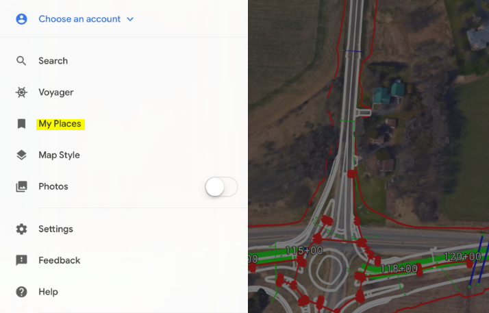
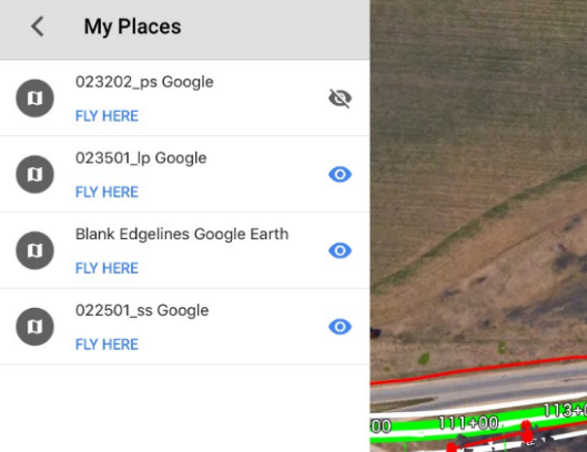
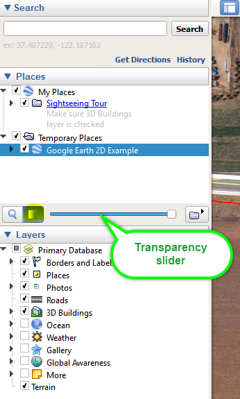
Under Places > My Places
- The files can be turned on/off by checking the box next to the file name
- The transparency can be adjusted by highlighting the file name and moving the slider
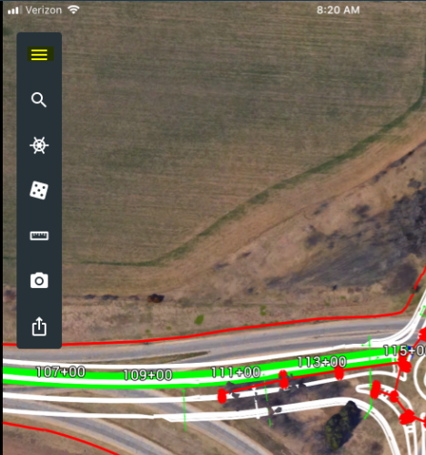
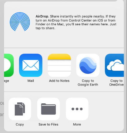
View the file in Google Earth (iPad/iPhone)
- Download Google Earth application
- Email or download the file to the device
- Copy to Google Earth
- Turn on/off layers by expanding the menu and selecting My Places