Reports - Parcel Legal Description
Last updated: 2021-06-29
Overview
This report creates a .txt file of a legal description of one or more parcels.
Usage
WisDOT Survey tab > Survey panel > Reports menu > Parcel Legal Description
The report can also be accessed from the command line: DOTREPORTPARCELLEGALDESCRIPTION
-
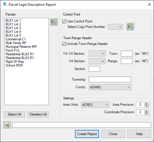
Parcels:
-
Select parcels from the list to be included in the report.. Use Shift or Ctrl buttons to select multiple parcels.
-
Use the select button to add parcels from the drawing if they are not already in the list.
-
-
Control Point: (Optional)
-
Select a COGO point from the menu or use the select button to pick a COGO point from the drawing.
-
-
Town-Range Header: (Optional)
-
Select from the menus and enter values for Township-Range and County.
-
-
Settings:
-
Enter precision values and select units for area calculation.
-
-
Click the folder icon to open the Save File As.. dialog.
-
Create Report
-
The report will auto-open in Excel.
-
Save the report.
Sample report