Insert Mapping File
Last updated: 2026-01-06
Overview
Insert Mapping File is a tool to make it easier to insert DWG's that were converted from Microstation DGN to AutoCAD DWG (Using Microstation) into the latest WisDOT Civil 3D Survey template. Inserting the converted DWG into a fresh WisDOT Template DWG allows the final drawing to contain all up to date components (Layers, linetypes, blocks, text styles, and multileaders).
After creating a new drawing with the WisDOT Survey Template, the tool is executed. The tool will insert all of the latest components (Layers, Linetypes, Blocks, text styles, multileaders, etc) and then ask for a file to insert. Once the file is inserted, the tool will zoom extents, purge unused components, and set the annotation scale to 1IN : 40FT.
An example of using this tool in a workflow is included here: Create topo file from Mapping
Using the Command
-
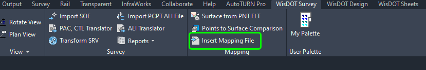
WisDOT Survey Tab > Mapping Panel > Insert Mapping File
 a
a -
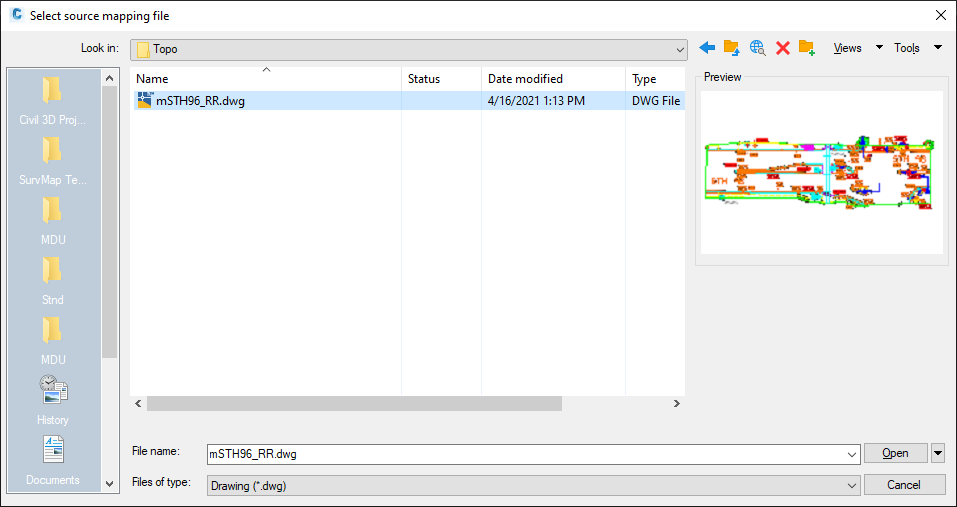
Select the DWG that was exported from Microstation > Open
- The chosen file is inserted into the drawing.
- Repeat the command if more files need to be inserted.