Using the Civil 3D Bing map feature for the first time (WisDOT employees)
Last updated: 2016-03-08
Civil 3D Bing map feature
In Civil 3D 2016, any time you assign a coordinate system to a drawing, or open a drawing with a coordinate system assigned, the GeoLocation ribbon will automatically appear.
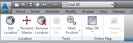
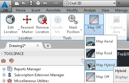
To access a Bing Roadway, Aerial, or Hybrid map, make your selection through the Map pull-down menu.
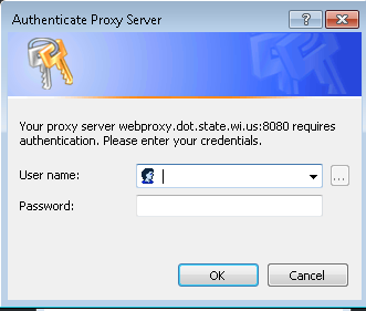
The first time you use this feature, you will be prompted to log on to the dot proxy server. Use your dot computer logon username and password.
Next, you will be prompted for an Autodesk A360 username and password. If you already have an A360 account, enter your credentials and the Bing map will appear.
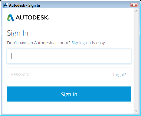
If you do not have an A360 account, you can sign up for a free account at this address.