Export road linework from InfraWorks to Civil 3D
Total video time: 4:57
The WisDOT coordinate projection zone category which was in use through Civil 3D 2016 and 2018 has been retired and is no longer needed in Civil 3D 2020 and beyond.
Coordinate systems in Civil 3D should only be applied when a projection transformation is needed.
Projections for Civil 3D 2020 and beyond should be selected from the Zone Category: USA, Wisconsin. WISCRS projections begin with NSRS2011 Wisconsin County CRS
Projections for Civil 3D 2016 and 2018 should be selected from the Zone Category: WisDOT.
Create InfraWorks model and export to IMX
data-xchng-xprt-rd-linwrk-IWX-to-C3D-01.mp4 4:57
Home Screen > Click Model builder
-
Model Builder Dialog Box
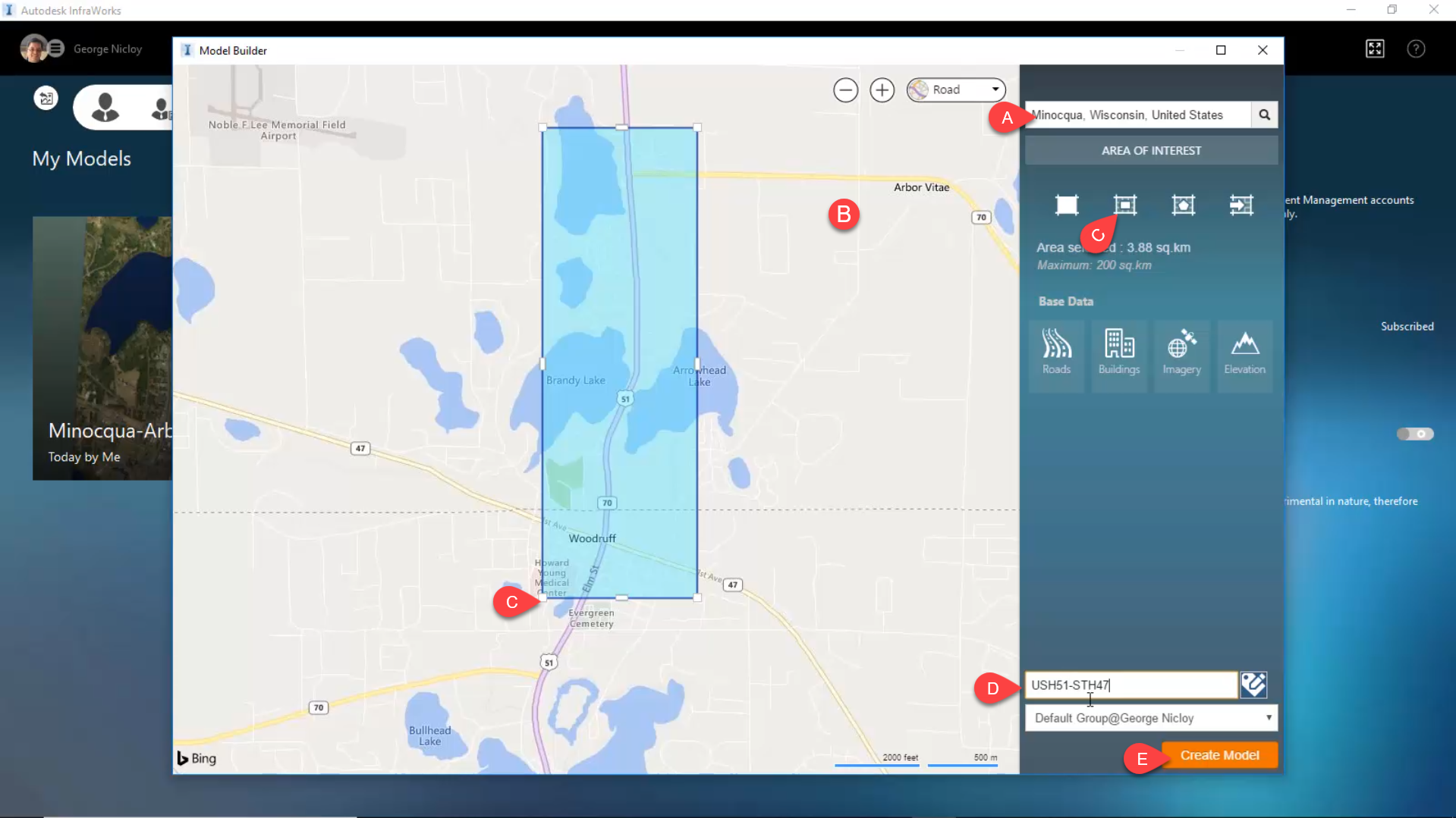
- Search By Location: Minocqua, Wisconsin, United States
- Model Window: Pan and Zoom to area of interest
- Area of Interest: By Rectangle
- Model Name: USH51-STH47
- Create Model
- Model Builder Confirmation Dialog Box > Close
- Model Builder Dialog Box > Close Dialog Box
Home Screen > Click USH51-STH47 Thumbnail
- Settings > Model Properties > UCS Globe
- Category: WisDOT
- Code: Double-Click WCCS-vilH8391USF
- Road Design standards: AASHTO_Imperial_2011
- Settings > Export IMX
- Target Coordinate System: Confirm WCCS-vilH8391USF
- Target Files: Left-Click Folder Icon "N" Drive\PDS\C3D\11701970 - prjct-ovrvu\basedata\other
- File Name: USH51-STH47_export.imx
- Save
- Extent > Define Interactively: Polygon
- Create Polygon to reduce extraneous data in model
- Double Click to complete Polygon
- Export
This topic is followed by Project overview sheet